Safety in the Sea

With the temperature soaring, there’ll be a lot of people making their way to the coast to have a dip in the sea, so it seems like the perfect time to talk about tides, currents, waves and an excellent app that can help you navigate your way through it all. But let’s start with a little story.
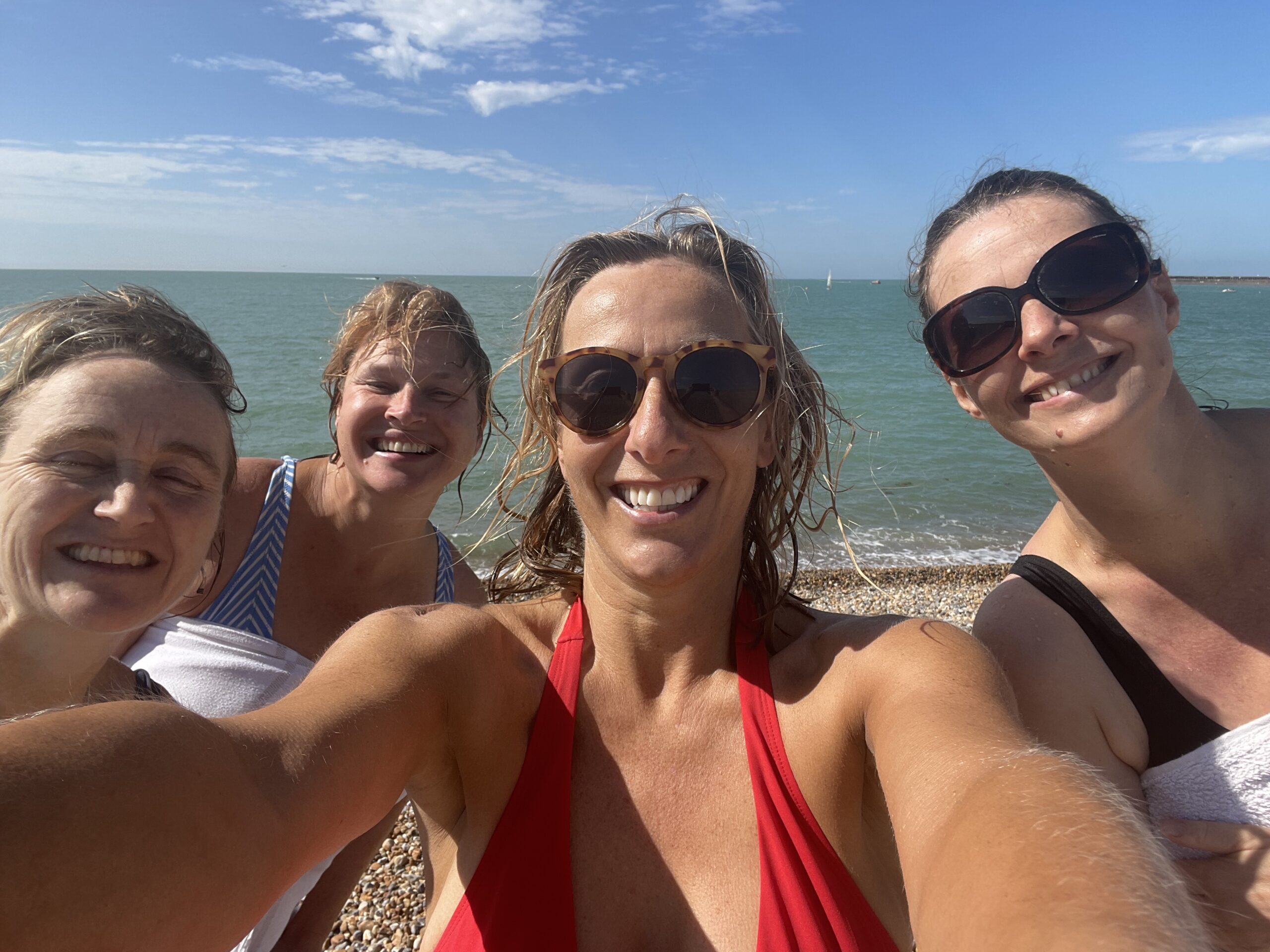
Last summer when I was at Seaford with friends, we decided to swim out to the buoy directly in front of us. We got into the water and headed off, but it wasn’t long before we realised there was a drift which was taking us to the next buoy along – some distance towards the west. After swimming against the current for a good 25 minutes, we bailed and ended up swimming back to the shore, knackered. We got out of the water a hundred meters or so along from our clothes slightly red-faced but otherwise unharmed.
On that occasion, we only had to deal with a walk back, but it could have been far worse if the conditions had been less favourable. The simple truth was, we didn’t understand which way the drift would be taking us, and so didn’t plan accordingly. The good news is, learning how to read the tides and drift is fairly straightforward.
Tides
Let’s start with the UK tides, as they’re driving force behind it all. The way to think about how they work, is to picture two large slow-moving waves caused by the effect of the moon’s gravitational pull. One travels west to east, from Land’s End around to the Thames Estuary, and the other travels north up the west coast of England, around the tip of Scotland then down the east coast. The two converge off the Thames Estuary.
The waves have peaks and troughs, a peak being a high tide and a trough low tide. In 24 hours there are 2 high and 2 low tides, with a six-hour span between each.
In truth, it’s not exactly 6 hours, so looking at today’s tide time in my local spot, high was at 4:35am, low at 10:59 am, high again at 5:13pm. Each day the tide times move on about 50 minutes, which is why it’s important to have a good app which shows you all this – but more on that later.
Back to the south coast. With them, the tides also bring a drag, which will run the opposite way to the general west to east tidal direction. The way to think about this is, when you see a wave crashing on the beach, you also get water sucked back which pulls out to sea. This drag works in the same way for tidal waves. Approx. 2 hours either side of high and low tides, there’ll be more drag one way or the other.
Taking the west to east principle again, at high tide water will be pulled towards the west, and at low tide it’ll be pulled towards the east. It’s important to know the tide times so you can judge direction and also speed of the tidal streams which flow along the coast. The time the streams change direction is called slack water. This is when they’re weakest in any direction. After slack, they speed up for three hours, and slow down for the next three before repeating the cycle in the opposite direction. Knowing this and understanding how the tidal waves flow around the country will help you plan your adventures. For example, if you want to paddleboard or kayak along the coast, you’ll want to ensure you travel in the direction of the tidal stream and come back once it’s turned.
So back to my example where we headed out to our buoy. What I now realise is that we must have been within approx. 2 hours of high tide, as we were being pulled towards the west. So, check your tide times, and be aware what will be happening when you plan to get in!
Spring and Neap Tides
No, nothing to do with the seasons, spring tides occur whenever there’s a full or new moon so roughly every 2 weeks, and is where the tides are at their most extreme. So, the highest high tide and the lowest low tide. Neap tides follow 7 days later, and are when the contrast between high and low tide is at its lowest.
The impact this can have on the sea can make the difference between whether the same weather conditions make it safe or unsafe to go into the water. So, for example spring tides will be higher up the beach, and the peak will have more water. The water will also be moving faster.
Neap tides are mellower, so even at high and low tides, when the water is moving at its fastest, it won’t be as fast as at spring tide.
Waves
As well as tidal waves, there are waves which are created by the wind and geographical circumstances. The largest waves are formed when winds are very strong, blow for lengthy periods and cross large expanses of water. So, the south west of England is affected by the UK’s prevailing south-westerly winds, which have a long reach – all the way across the Atlantic. That’s why it’s a great location for surfing!
In brief if the wind is onshore, the waves will generally be larger than those with an offshore wind of a similar speed.
Shore Dump
Finally, you’ll need to take into consideration the shore dump, which is basically how the waves meet the shoreline. The wind, the slope of the sea floor and the tides all influence this, and it will impact how easily you can get in and out of the water safely. Only 15 cm of water can knock you off your feet, so bear this in mind when you are contemplating getting in. A steep beach at high tide with large waves must be treated with great respect.
Putting it all together
There are some fantastic apps around that can give you a lot of the information you need to determine when and whether to go in the water. It’s always best to consult more than one source, but of course even the experts can get it wrong. So if your app says it’s looking great but you arrive to 6 foot waves, you may want to reconsider your swim!
For overall weather, you can’t beat the Met Office, but to give you more specialised knowledge on local tides, predicted wave height and shore dump, Surfline is a great all-rounder.
You can select your local spots, clearly see when it’s high and low tide, as well as shore dump, predicted wave height, wind direction and wind speed. And if there’s a webcam in situ, you can see that too.
If you want to read up on all of this in more detail (and with some very nifty illustrations) check out the fabulous books by William Thompson, including The Book of Tides and three pocket sized guides The Moon, Tidal Streams and Tides.
But most of all understand the conditions, and then get out and enjoy the water!